How to
How to Check Wildfires And Air Quality Index On Google Maps
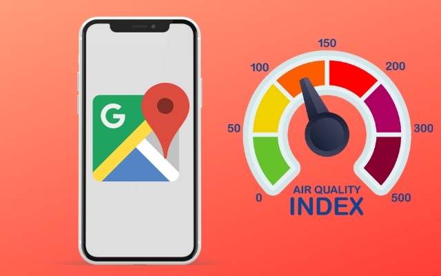
Recently Google Maps has included new features in their app. There are two new layers in the viewing options. Till now you can overview the traffic, directions, street view, and 3D Maps. In addition to that information, users can check air quality index on Google Maps and get updates on the ongoing wildfires. Interesting, right? In this post, we will show you how to check air quality index on Google Maps and get wildfire information.
But there is one thing to note here. Right now, the feature to check AQI index on Google Maps is only available in the United States, India, and Australia. The wildfire layer feature, however, is supported in many other nations. Even if Google Maps is unable to retrieve pertinent data for a certain country, these functionalities are nonetheless accessible to explore in any nation.
Google Maps New Layers: AQI Index & Wildfire
Many of us are taking advantage of the chance to enjoy the great outdoors as the summer vacations officially begin across India. Now you may use these two features of Google Maps to be safe and healthy while participating in summer activities.
Knowing the air quality conditions, such as if it’s exceptionally foggy, might be beneficial while travelling to a new location. To help you decide if it’s safe to go on a trek or other outdoor adventures, check wildfires and the air quality index on Google Maps. This feature is available on both Android and iOS.
The Air Quality Index (AQI) will show how clean or polluted the air is, including whether it is smoggy, smokey, otherwise terrible, or just great. The Wildfire layer will show you if there are any ongoing hazards in forests. You’ll also get suggestions for outdoor activities, the date the data was last updated, and more information.
How to Check the Air Quality Index On Google Maps
We believe that this function will soon be accessible in all nations. So keep an eye out whether Google has begun supporting your nation or not. Keep in mind that the online app of Google Maps does not have access to the AQI index layer. Here’s how it works:
- Launch the Google Maps application on your iOS or Android device. The desktop online version of the feature is not yet available.
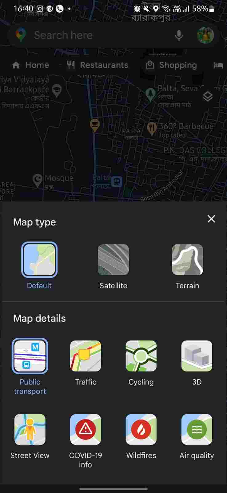
- Click the Layers symbol in the upper right area, just below the search.
- After that, tap on the Air Quality symbol in the bottom right of the menu that appears.
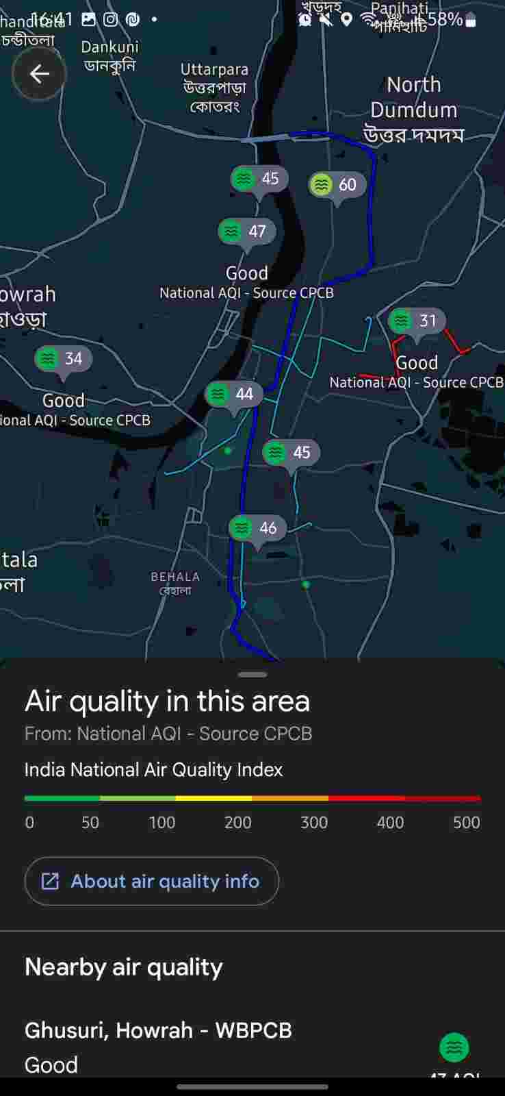
- Now you will see bubbles containing AQI index numbers at the top of every location. You can also zoom out on Google Maps and get information on air quality indexes for large areas.
- To check AQI index of your locality, zoom in to get bubbles with numbers. The index number that is lower indicates better local air quality.
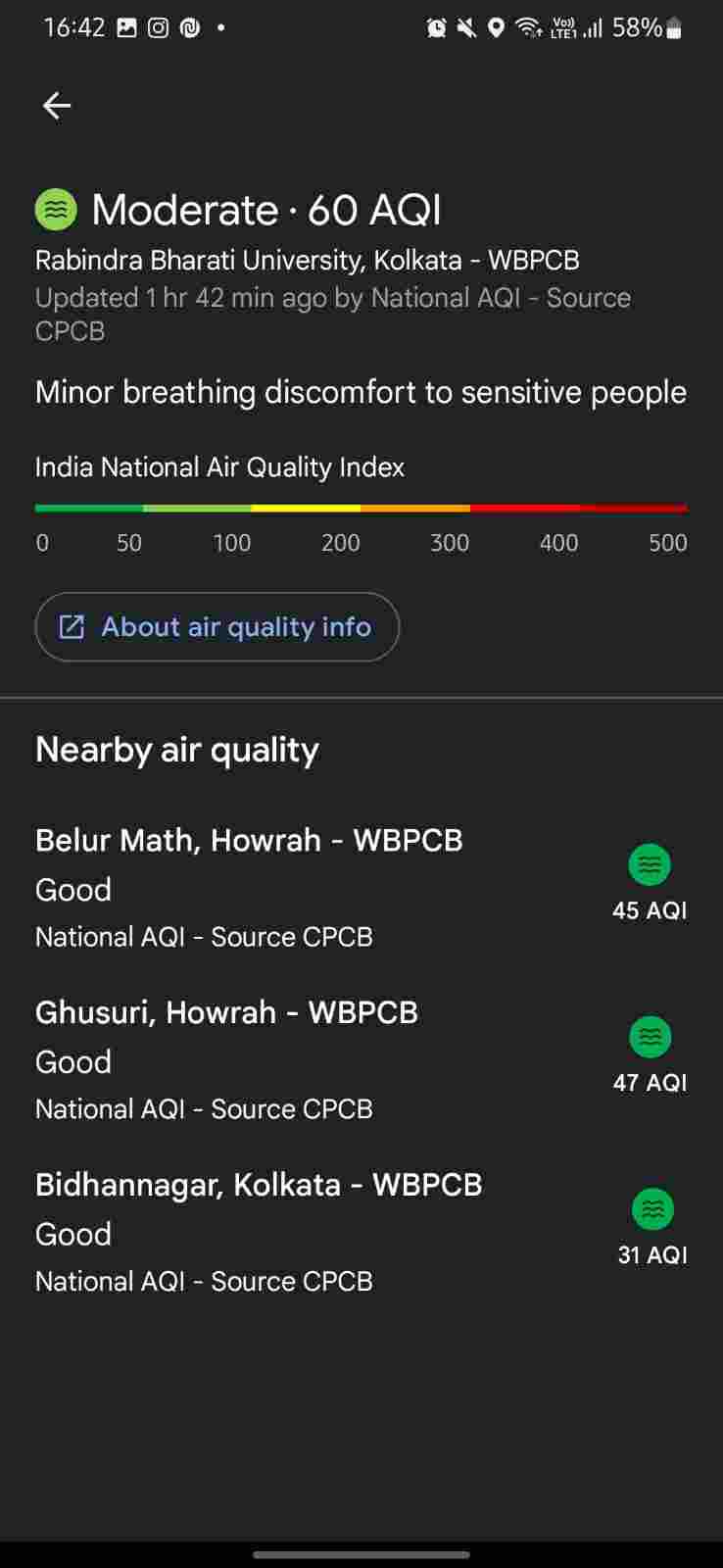
- Clicking on any bubble will reveal a little menu below with further information. It tells about the effect on the local population, the quality rating, and whether it is healthy or harmful. You will see a color-coded bar chart as a standard quality index.
So, as you saw it’s quite simple to check Air Quality Index on Google Maps and understand the air quality information displayed there. To find out whether the location has good, moderate, or poor air quality, just click on the AQI bubble. Besides, you may check the source of the data, the date it was most recently updated, and other links for more information. All this is available in the menu that appears at the bottom.
Check Wildfires On Google Maps Before Outing
Wildfires have grown in number and intensity recently, both domestically and abroad. Do you know? Over the past year, Google searches for “best air filters for wildfire smoke” and “best mask for wildfire smoke” have increased in popularity in the United States. Therefore, Google decided to provide this information at the fingertips of everyone. So that you can avoid wildfires safely as the wildfire season approaches.
It was possible because of Google’s collaboration with the National Interagency Fire Center. Before you go on any outdoor activities, check wildfires on Google Maps and get additional information about nearby active fires. For major wildfires, you can also search for “wildfires near me.” It will show you relevant data on the fire as well as information related to the air quality.
In the upcoming months, Google Search’s air quality data will include smoke data from the National Oceanic and Atmospheric Administration (NOAA). The United States will get this update first. According to Google, they want to deliver dependable information and resources. So that everyone feels comfortable and knowledgeable while going on walks, camping vacations, and other outdoor activities, taking full advantage of the summer.
Steps To Check Wildfires On Google Maps
The wildfires layer is available on Android, iOS, and web apps for Google Maps in addition to the Air Quality Index. Besides the United States, India, and Australia, it supports additional nations, including numerous European nations.
For the Google Maps Mobile App
- Launch the Google Maps app on your Android or iOS mobile phone.
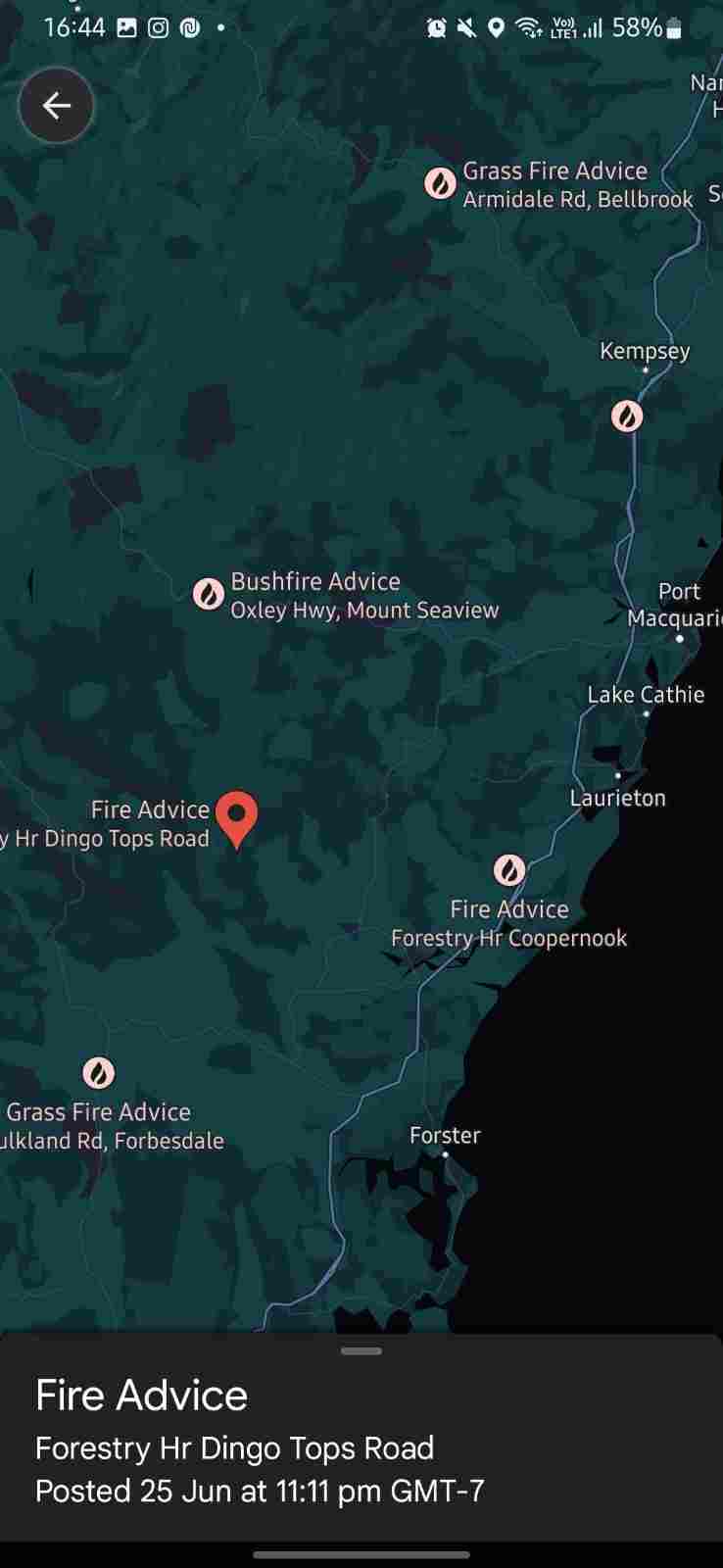
- Open the Layers option in the top right corner of the screen. Then select the Wildfires layer from the menu below.
- At this point, you should see the nearby flames that are now raging. To access additional information, tap on the wildfire icon.
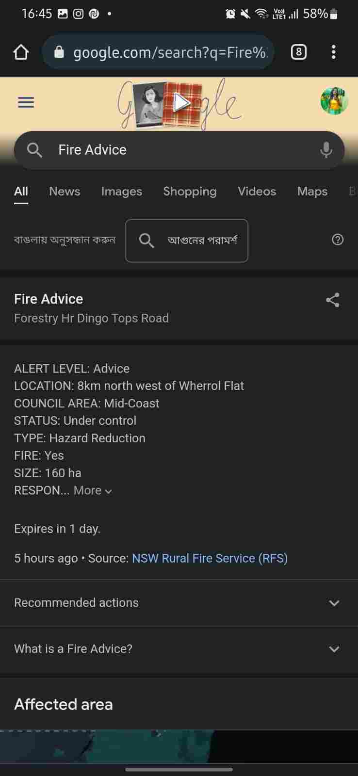
- Now choose the See the newest changes option. It will open Google Search for additional information like news, videos, and more.
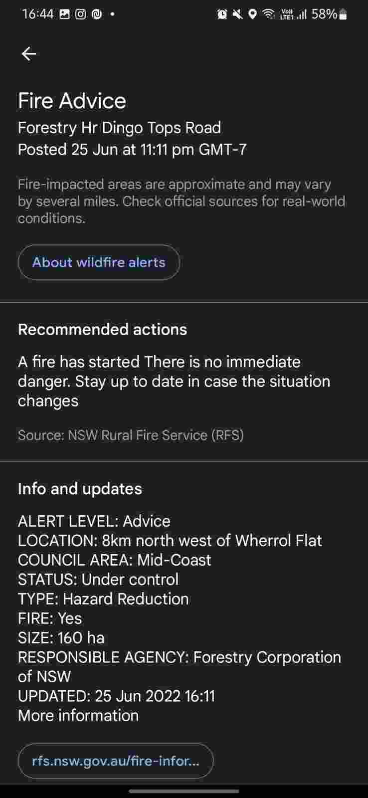
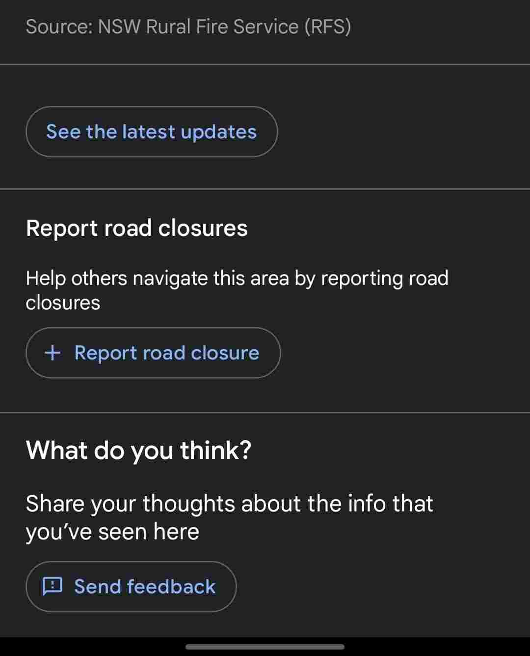
There are some useful tools in this feature. The first one is that you can report a road closure from the information page for Wildfires. The other is that Google Maps will notify you if it discovers you are close to an active wildfire. Now, let’s know how to check wildfires on Google Maps desktop web version.
For The Desktop Web App For Google Maps
- Open the browser of your computer, search for Google Maps, and open it. Click the Layers symbol in the lower-left corner of the Google Maps page after it has loaded in the browser.
- To access other Layers, tap on the More option.
- After that, you can see all the viewing options. Select the Wildfires tile from the menu that appears.
- You may now view all of the ongoing wildfires worldwide.
- By clicking on one of them, a side panel containing further information about the wildfire will open. You can view the most recent changes, news, videos, and choices to block roads report in the sidebar, just as on the mobile app.
So, that were all the steps on how to check Air Quality Index on Google Maps along with knowing about active wildfires in the surrounding areas. Now we will discuss some common questions about the air quality index. So, without any further ado, let’s get started.
FAQs About AQI Index Of Google Maps
Where Does Google Get Its Data for the Air Quality Index and Calculate It?
For information like wildfires and the air quality index, the reliability of the source is more crucial. As much as we researched, Google Maps outsources this information from a number of governmental organizations, environmental protection organizations, PurpleAir, AirNow, the National AQI of India, and EPA Victoria for Australia and other partners.
Information sources that might help you find out more about the air quality in your region:
- Government surveillance facilities: Governments use station readings to construct the air quality index (AQI). This AQI is shown on Maps exactly as is.
- Non-regulatory Partners: Google uses its sensor readings to compute a weighted average using the NowCast method when the partner isn’t an official government monitoring station. In this case, the adjustment factor from the US Environmental Protection Agency is used.
The air quality data can be affected by a variety of variables, including:
- Wind direction and speed
- Landscape
- Puffs of smoke
- Additional sources of fine particle pollution
Readings of the air quality can differ between places due to uneven pollutant concentrations over short distances. The quality of the air can also be impacted by contaminants not shown on the map.
Where Does Google Get Its Wildfire Information?
Google always tries to provide the most accurate information to its users. For that, Google has cooperated with the National Interagency Fire Center (NIFC). Besides, they have partnered with various organizations such as the National Oceanic and Atmospheric Administration (NOAA) for the US, and the NSW Rural Fire Service (RFS) for nations like Australia.
Wrapping Google Maps’ Wildfires and Air Quality Index Feature
It’s great that we can get such crucial information on an app we already know and adore. The air quality index, however, is a new addition and needs to cover a lot more nations. Also, Google needs to make it accessible on the desktop web version like the wildfires function. The provided information ought to be more specific and in detail.
Recently we have seen how Delhi is struggling with the air quality. So, people should check AQI index before heading out on a regular basis and may obey the suggestions for people provided in the menu. Also, keep updated about the active wildfires surrounding your area to avoid any danger. If you know about any ongoing hazard in your local forest area, ensure to report it.
So, that’s all for today. For more Google product updates and guides, keep your eyes on TechBurner!